
As part of Team-Thrusight – Polaron was to be used to present Wall penetrating radar data – to allow real-time tracking of firefighters and the identification of potential casualties or civilians – in order to augment body worn tracking solutions and offer standoff situational awareness.
Our partner Fabio-da-Silva presented the findings at PSCR 2022 in San Diego, USA and despite getting to the paid prize of Phase 2, in Phase 3 the organisers re-orientated focus onto body worn tracking of first responders in indoor spaces and not in sensing behaviour of patterns of life, or detection of civilians or threats from a standoff position and thus there wasn’t an opportunity to progress with supplementing situational awareness through being able to sense through wall.
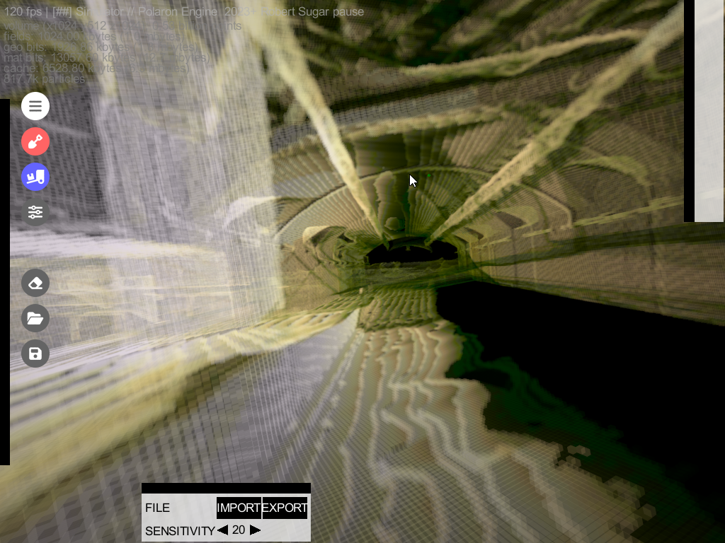
We were able to show that the M-Widar system from Wavesens could provide meaningful data that could be processed to penetrate and sense the presence of static or mobile occupants behind the wall.
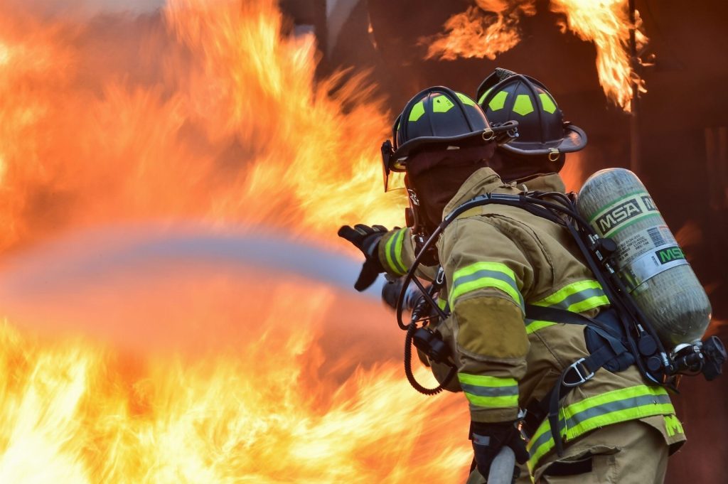
Testing included taking the M-Widar system to a real “smoke house” (a firefighter training area, in order to obtain data and look to refine the sensing in a realistic approximate environment and return data that could be processed and presented back in real-time to the Firefighter – or pushed into other Situational Awareness tool or platform (CivTak / ATAK / etc).
Tracking and situational awareness has long been a problem for first responders. While GPS tracking can roughly establish where on earth a person is, it is often not accurate enough to ascertain a person’s location or elevation within a building. Knowing the exact location of first responders within a structure is vital to their safety during a search and rescue operation.
This competition is ongoing and aims to identify 3D tracking technology that can give first responders one-meter accuracy in an indoor setting. Use cases include emergency rescue operations and survivor location within large buildings – either with or without Apriori information or mapping data.

FRST Challenge:
Tracking and situational awareness has long been a problem for first responders. While GPS tracking can roughly establish where on earth a person is, it is often not accurate enough to ascertain a person’s location or elevation within a building. Knowing the exact location of first responders within a structure is vital to their safety during a search and rescue operation.
Date:
2022-2023
Project Links:
Winner – CommanDING challenge:
“Best Adaption of existing technology for public safety use”
Date:
Winter 2022
Urban Hawk was awarded best in class at the CommanDING challenge in the category “Adaption of existing technology for public safety use” with the Polaron World Engine presentation.
Urban Hawk (makers of Polaron) was awarded best in class at the CommanDING challenge in the category “Adaption of existing technology for public safety use” with the Polaron World Engine presentation. In part due to the ability to process very large amounts of data and present this back in realtime in a full 3D engine – as well as mining this data for insight and providing a clear picture of the operational environment.
“Leake Street Graffiti Tunnel” (https://skfb.ly/6TFJV) by artfletch is licensed under Creative Commons Attribution (http://creativecommons.org/licenses/by/4.0/).
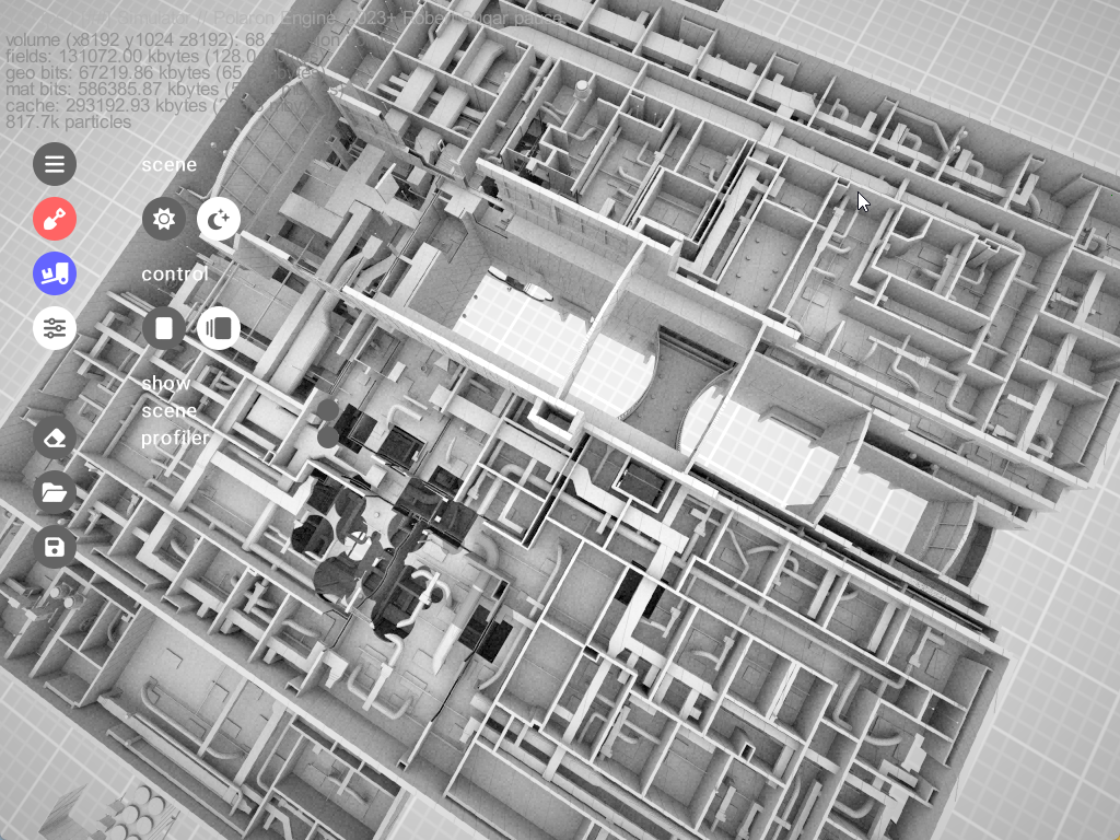
CAD / BIM Model kindly provided by XBim-Ltd all rights for the model belong to Xbim-Ltd (they’re also great if you want experts in BIM and interoperable construction).