Introduction As warfare and its tactics evolve, so does the need for advanced simulations to model potential scenarios. The inclusion of fully destructible voxelised terrains in serious simulations offers an unprecedented level of detail and realism in urban warfare scenarios.
This approach not only allows military strategists to understand modern combat dynamics but also aids urban planners in assessing the resilience of infrastructures under extreme conditions.
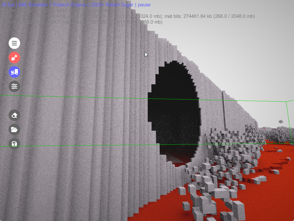
This means entire buildings, underground systems, and other infrastructures can be destroyed, modified, or rebuilt.
John Tapsfield – CTO – Urban Hawk Ltd
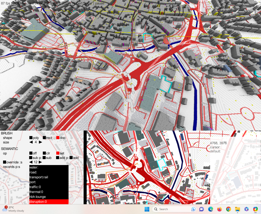
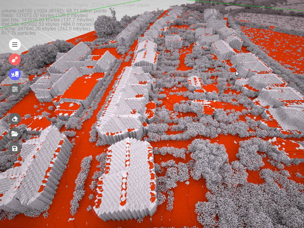
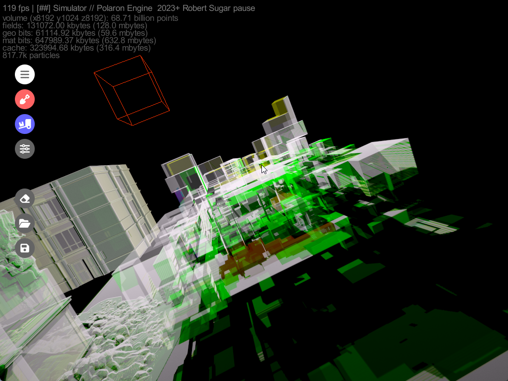
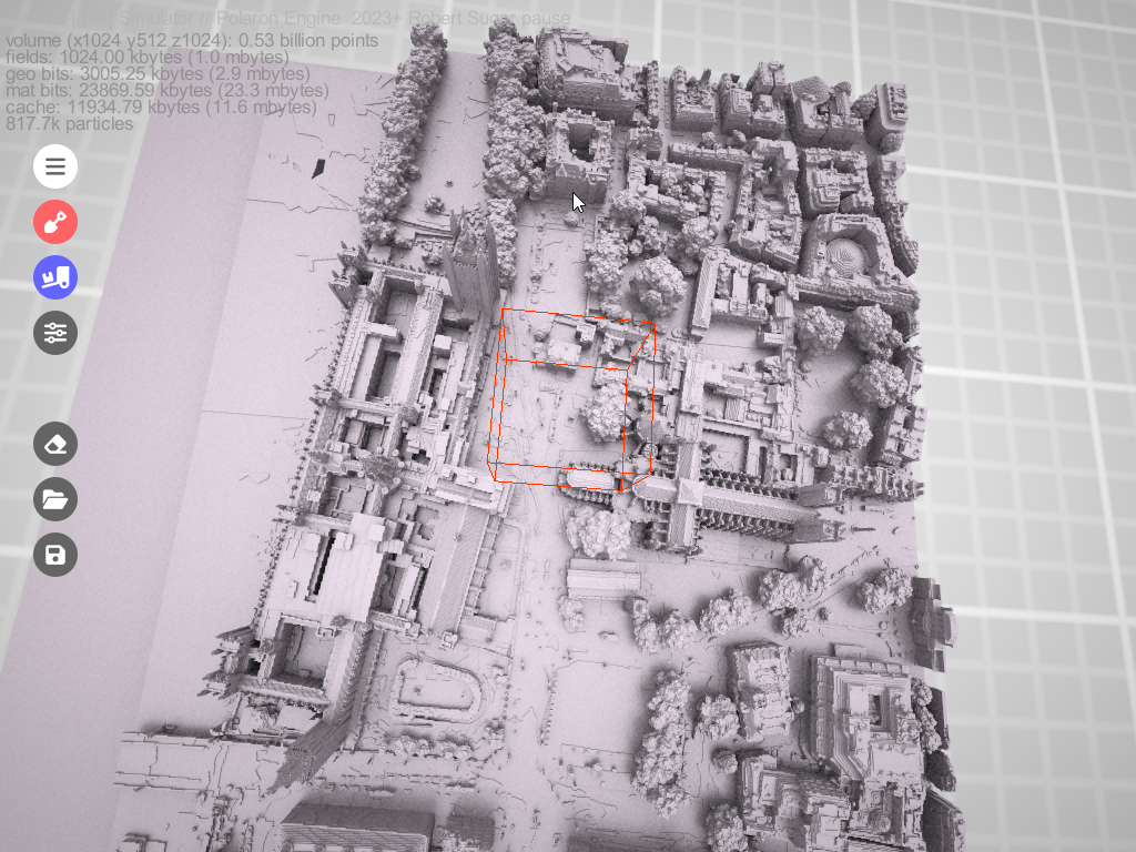
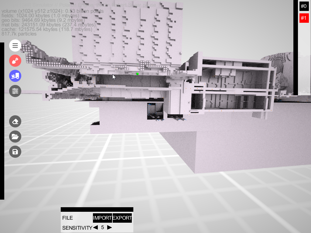
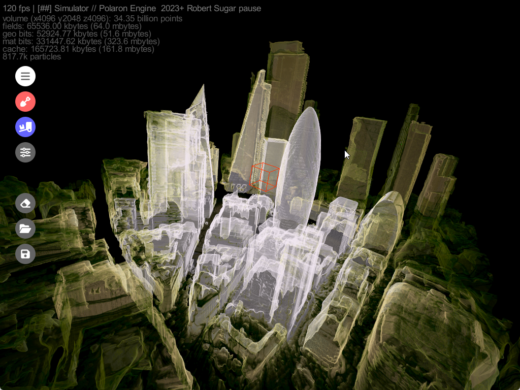
The Rise of Voxelised Terrain in Serious Simulation Voxels, the three-dimensional counterparts to two-dimensional pixels, have emerged as a game-changer in the simulation space. Unlike traditional methods, voxel-based simulations allow every minute part of the terrain to be modelled, altered, and interacted with. In the context of urban warfare, this means entire buildings, underground systems, and other infrastructures can be destroyed, modified, or rebuilt.
Typically we are now using procedural generation and semantically derived data to generate 12.5cm cubes of data – mapped to their associated semantic data (ie it’s a road, house, roof, window, etc). 12.5cm seems like a good balance of detail vs granularity within a compute budget.
Additionally Commercial SAR has only recently been granted permission to sell SAR data at 16cm – and Lidar or Photogrammetry overflights is not always possible or incurs a time penalty in collection to deployment.
Applications in Urban Warfare Modelling
1. Realistic Battlefield Scenarios:
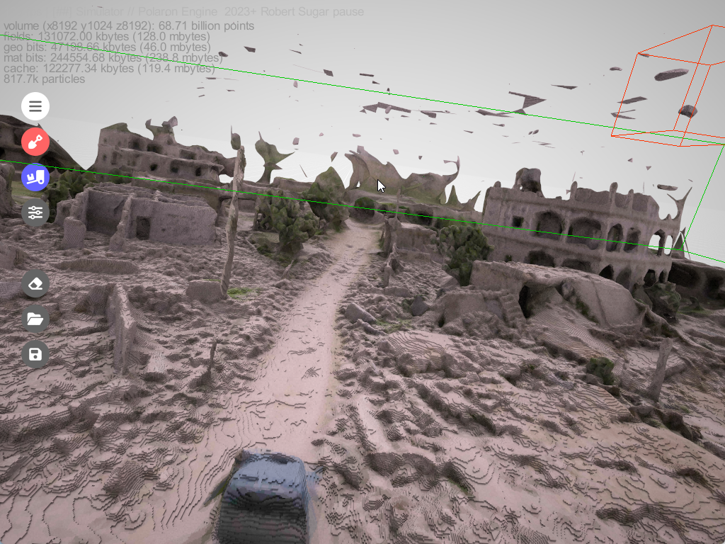
With voxelised terrain, simulations can depict the true nature of urban warfare. Buildings can be destroyed or used as cover, underground passages can be exploited, and the entire battlefield can adapt in real-time, offering strategists an unparalleled level of detail and realism.
2. Infrastructure Resilience:
By simulating warfare scenarios on voxel terrains, city planners and defense agencies can pinpoint infrastructure vulnerabilities. This can help in designing urban environments that are not only functional but also robust against potential threats.
3. Training and Strategy Development:
For military personnel, training on voxel-based simulations provides a much closer experience to real urban warfare. This enables better preparedness, more strategic deployments, and potentially, more effective outcomes in real-life operations.
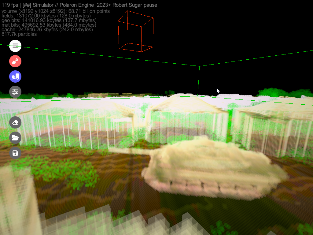
4. Our Physics system presents the presentation of weapons effects:
Instantiation (the swapping of damage models) is often not sufficient for modelling larger scale effects or blast areas. Additionally different materials and structures respond differently. Whilst we make no claims to perfect simulation (if such a thing exists) we can use this data or known effects to represent and simulate the impact of fires within an Urban Environment, and their effects on infrastructure, buildings and even on the behaviours of it’s inhabitants.
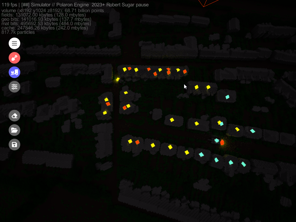
5. Behaviour of Civilians, Non-combatants and Push and Pull factors within Urban Environments
For military personnel, training on voxel-based simulations provides a much closer experience to real urban warfare. This enables better preparedness, more strategic deployments, and potentially, more effective outcomes in real-life operations.
Course of Action Analysis with Voxel Terrain
Adaptive Tactics:
The dynamic nature of voxel terrains requires constantly evolving strategies. Military planners can test multiple courses of action in rapid succession, determining the most effective tactics for specific scenarios.
With the age of drone warfare, alongside an incredible advance in sensors and detection methods, increasingly it looks like fighting will become closer (hugging the enemy for protection) the need to train and comprehend in dynamic environments with more realistic effects is paramount.
Specialised units & Specialised Tactics fighting up close:
Stuart Lyle of DSTL describes the close proximity of contemporary urban engagements (often within 50m) and the need to consider individual squad tactics and capabilities as well as thinking about remote fires and support functions.
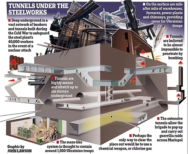
Underground and Strongpoints
As seen in Ukraine, fortified positions, bunkers and underground locations will need to be cleared and entered. Mapping these is incredibly difficult, let alone penetrating and attacking into them. By using probabilistic and procedural mapping, human analysis and modelling it becomes possible to arm soldiers with greater knowledge and situational awareness.
Civilian Protection:
In urban warfare, civilian safety is paramount. Voxel-based simulations can help strategists understand the potential civilian impact of various actions, helping to minimize collateral damage.
Post-Conflict Rehabilitation:
By understanding the extent of infrastructure damage during a simulated conflict, planners can strategize post-conflict rehabilitation efforts, prioritizing essential services and critical infrastructures.
Conclusion
The integration of voxelised terrains in serious simulations is reshaping how we understand and prepare for urban warfare. As the line between virtual and reality continues to blur, these advanced simulations will play a pivotal role in both military strategy and urban planning. The potential to analyse courses of action in such a detailed environment offers a promising future for urban resilience and warfare preparedness.