Polaron is a true voxel based simulation engine, named after a theoretical particle (our founder is a Physicist by training) since we’re presenting a representation of interactions between particles and points within a volume – ie Voxels!”
In the language of condensed-matter physics, the polaron is a quasiparticle formed by “dressing” an electron with a cloud of phonons, the quantized vibrations of the crystal lattice. Polarons may be large or small—depending on how the size of the lattice distortion they carry compares to the lattice constant—and tend to be effectively heavier than electrons, that is, harder to push around using electric fields.
American Physical Society
Polaron – World Engine (abbreviated to Polaron) was originally developed to process large GIS data sets and the spatial relationships between objects and entities for transport and insurance. It began life leveraging signed distance fields and at one point we believed it was capable of generating the highest number of splines in a COTs driven engine.
However – as GIS and Satellite data has evolved the engine has developed to support both large mapping functions as well as full 3d simulations leveraging a vowelised environment. People, Places and things all occupy space – that changes and interacts – thus by unpacking data stored in connected points, vertices and breathing life into Raster data – we can perform complex, large scale simulations across very large datasets. Rather than trying to compete on “shininess” or on cloud based simulation – we wanted to see how much performance we could squeeze out of COT’s technology, in order that we might permit simulations to run at real-time or in a hybrid setup.
Voxels aren’t suitable for everything – but offer a lot of advantages in a lot of areas.
What’s a Voxel in this context?
Since every point occupies space – each point in the volume can be thought of a tiny point of computation – able to impact and effect objects and effects being moved along, through and interacting with each point – and those around it. Equally every point can be changed, modified, updated and have logic or rules applied to it. This drives emergent and interactive behaviours in real-time – allowing for real-time updates from real-world sources – leading to real-time estimation and simulations.
Pros
- Voxels can represent fine details and smooth shapes very well, especially when compared to triangle meshes.
- Voxels can be easily transformed, scaled, and rotated without loss of detail.
- Voxels can be easily edited, such as by painting or sculpting, using simple algorithms.
- Voxels can be efficiently processed using parallel algorithms and hardware, such as graphics processing units (GPUs).
- It’s easy to create emergent behaviour by leveraging cellular automata and having multiple CA’s interact or stack up
Cons
- Voxels can require a lot of memory to store, especially for large grids or grids with high resolution.
- Voxels can be computationally expensive to simulate, especially when compared to other methods such as particle-based simulation.
- Voxels can produce blocky artifacts, especially when viewed from far away or when the grid resolution is low.
- Voxels can be difficult to work with when it comes to maintaining topological correctness and surface orientation.
So what?
Over the past four years – within Urban Hawk’s various commercial applications, we have worked to reduce the cons – decreasing the memory overheads, introducing caching, instantiation, and clever compression and adaptive methods to ensure performance in the simulations & engine. We’ve been able to show how our simulation and terrain can be pushed or pulled from other tools and services – be that Unity, or publishing into existing GIS or spatial formats.
We are interested in the aesthetic – but far more interested in the data – and have identified the sweet spot where representation of a thing – is good enough to engage with it – without needing to exhaust computer resources making it ultra realistic. For this – there are numerous companies and tools – from Unity, Unreal through to Omniverse and Metaverses – all ultimately prisoners of their resources. Whereas we want to focus and bring serious simulation to the consumer and pro-amateur in gaming whilst continuing to offer our services for professional applications within the commercial market (for instance our work within the 5G-Victori programme – a Horizon Europe piece of work).
Additionally we’ve come to see how fast the Satellite Observation and Ai driven terrain world has advanced, as well as the next generation of connectivity that allows for ultra-low latency simulation, gaming and sensor input.
What it means – is getting data at the speed of acquisition. Whether that’s navigation, train delays or simply making a plan with your mates. You can quickly string together hundreds and even thousands of variables – to find that one restaurant with a table, that caters for Vegans, with disabled access, good reviews and will get you fed before the party starts and get you all home before the last train.
John Tapsfield – CTO – Urban Hawk.
Real-time simulation over a phone
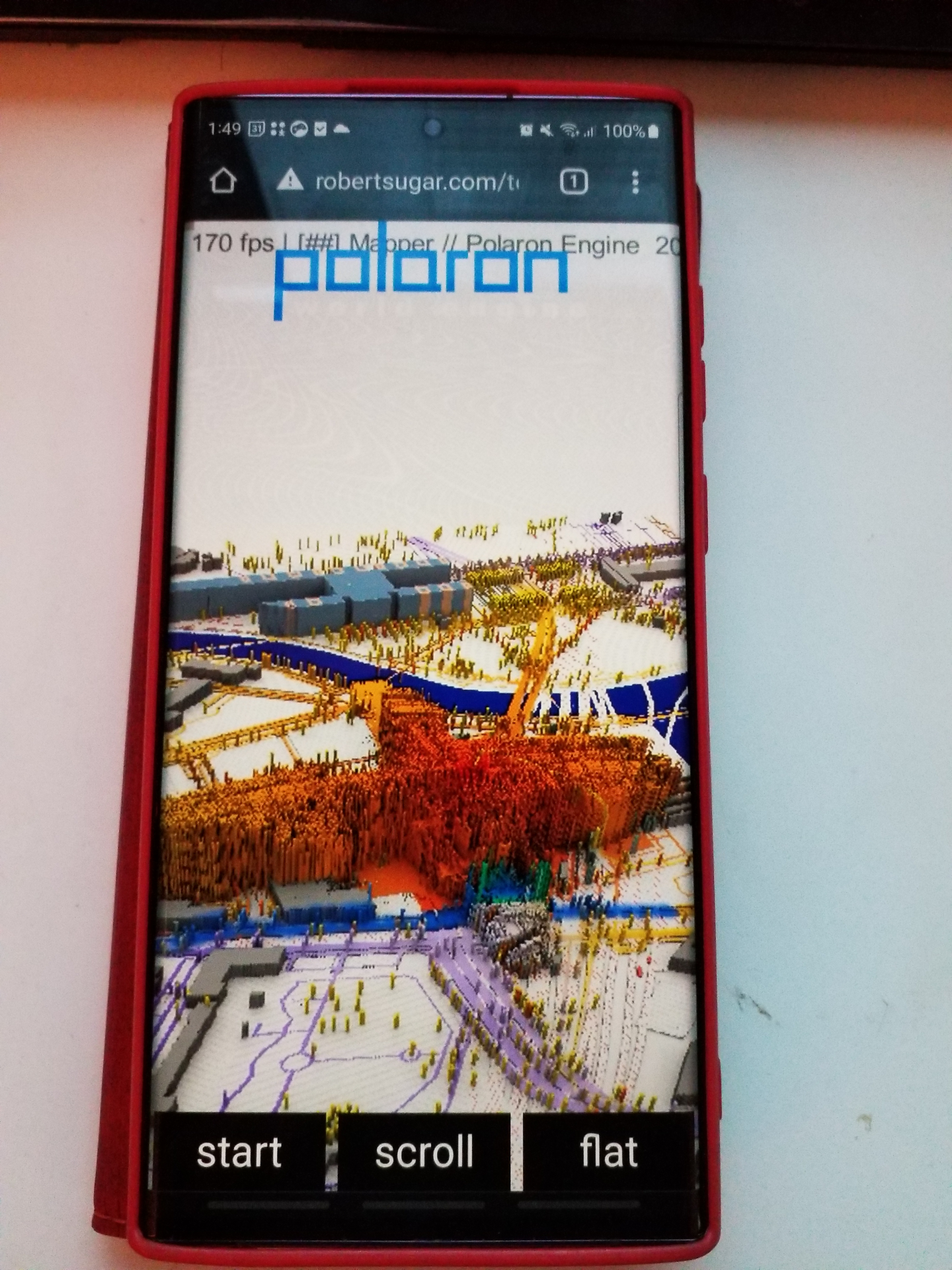
As Polaron was being developed – we’ve had the opportunity to explore multi-user planning experiences – and have enough performance to have over 10 x concurrent users all interacting into the simulation simultaneously over mobile devices; (despite the chaos of these early trials) we’ve been able to show the benefits of such an approach’s game like experience and providing a Miro / Online-collaborative approach to mapping.
So whether it’s an Insurance application based on semantically encoded data, blending transport information or statistics, heat maps or even temperature data from space, Polaron has been developed to support multiple concurrent users. Based on our market research and customer feedback – a consistent point was how poor collaboration was – and how decisions were difficult to assess in real-time – let alone to consider driving parametric decisions from that interaction.
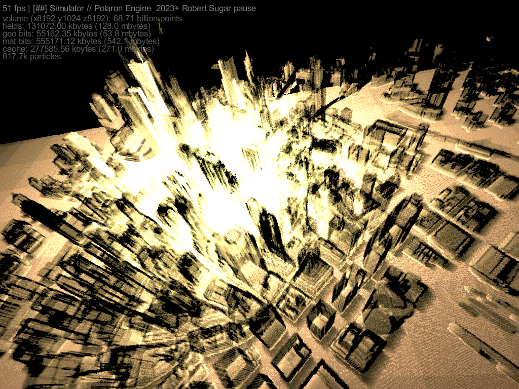
Therefore to serve both en-prem and cloud capabilities we had to get efficient. This focus has allowed us to stream and send real-time simulations and compressed data to mobile devices. Allowing multiple concurrent users and interactions, real-time data. The performance of the simulation allows for massive scale and complex real-time simulation (real-time means 30fps and often hundreds of fps) even when dealing with billions of points.
In Essence Polaron is a realistic and endlessly scalable, tweakable and replayable sandbox through which you can stress test decisions and deliver planning, risk awareness and training in a wide range of applications.
Polaron builds 3D maps & terrain models of areas, spaces and facilities over which a limitless variety of effects, incidents, operations and AI driven models can be simulated
Robert Sugar – CEO
Complexity in data & Values
This allows Polaron to provide a range of complex simulations evaluations of scenarios, analyses and even games. Using the incredible performance to send and issue data to and from end users.
Blending Minecraft, GIS and Big Data into one platform.
In layman’s terms, imagine representing the world as blocks (you can choose the scale, from countries, to counties to cities and even rooms) you can encode values into them. These range from:
- Colour values, transparency and occupancy
- Statistical Data (eg probability, population statistics and connectivity)
- Building materials, strengths and values
- Thermal, emissivity and hyperspectral data.
- Damage and Cohesion
- Networks and infrastructure and dependencies
- Transport and Travel networks
- Insurance and other Risk profiling data.
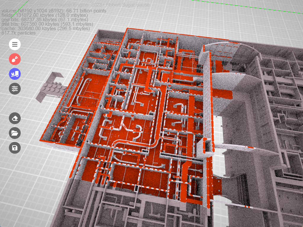
Polaron can ingest a huge range of different EOS data types such as Infrared, Thermal, Hyperspectral and more. The performance allows us to query changes & analyse patterns as well as
begin to create and “cache” individual profiles of different buildings and patterns that correlate to their use or profile (e.g. Residential vs Industrial vs Infrastructure & Infer patterns or use).
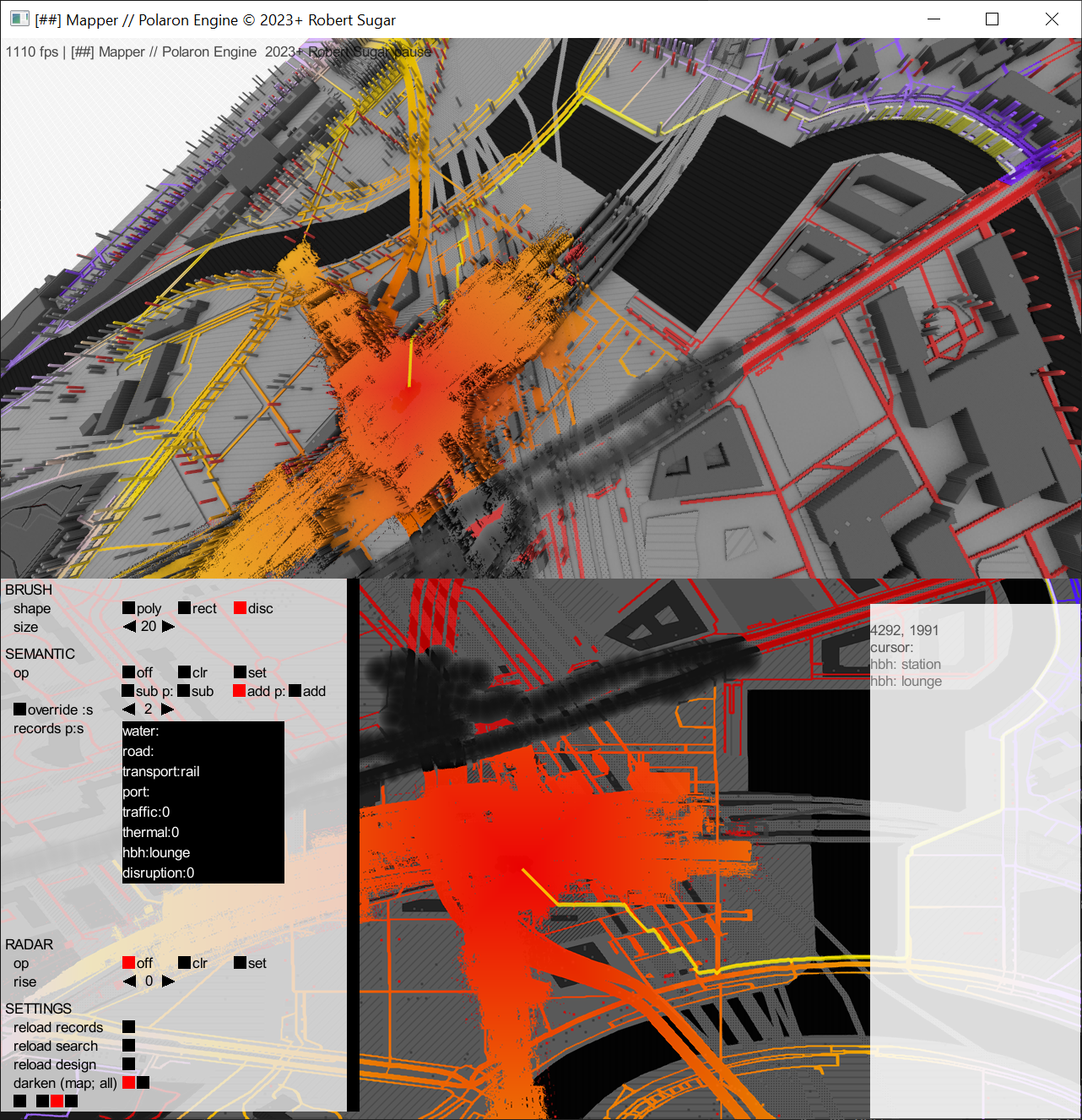
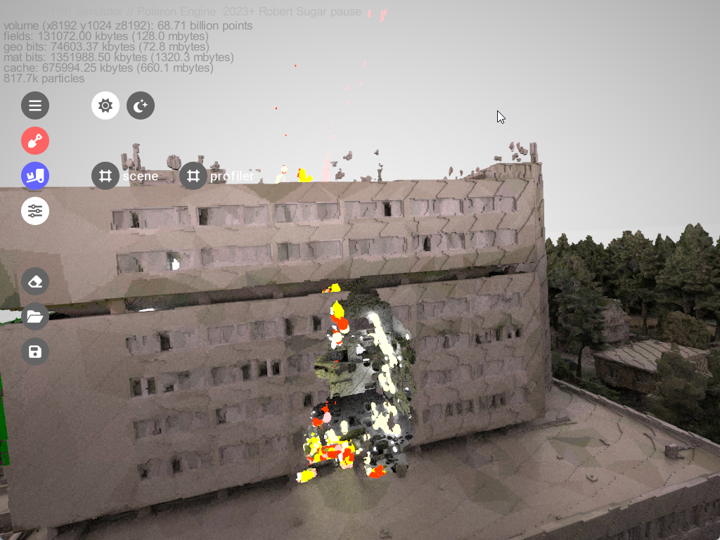
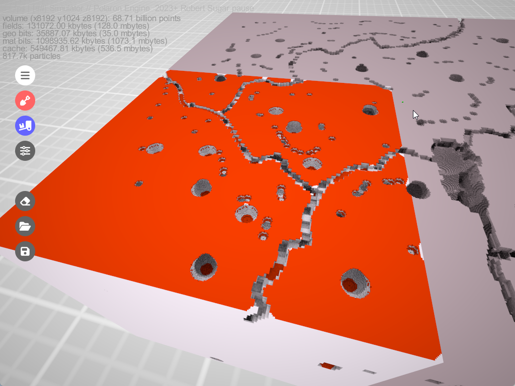
As you can see from the image below – there is no difference between a human adding / painting in data (in this case a climate protest blocking access to the Berlin Central Station) or automated inputs from APIs, MySQL DB’s or Graph Databases. The performance allows faster insight – and Polaron is designed to augment other tools and services.
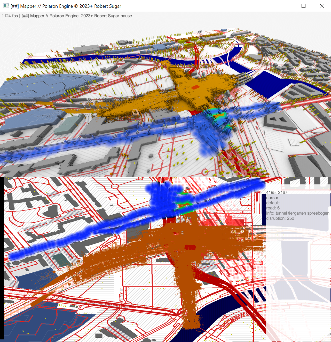
This can be 2D / 3D or 4D (the performance of the engine even allows us to scrub through time or playback realtime depth data). Then stream this to an end user device or even another application (such as game engines such as unity, and pushed data into QGis). As you can see below it becomes possible to produce different layers of simulation – and you can see some of the AI-Augmented Dijkstra path finding algorithm routing the journey around the protest.
Why not just use Unity / Unreal or ArcGIS?
All of these tools feature voxel layers, but whereas they are typically a layer or a component – a voxelised spatio temporal layer (blocks of stuff that can change in time) is the core feature of our engine. This kind of Voxelised layer is used in Robotics, and Autonomous cars – able to fuse multiple inputs and queries into a single common layer – in which rules and logic can be driven.
This allows us to have a lot of complexity and interaction between points and we can even stream in live video from depth sensors into hybrid environments.
Polaron has been architected to deliver the performance, scale or complexity of Voxel interactions and as such we’ve spent the majority of our time on the performance of interactions and with the ability to refine the aesthetic and even push this data into other engines. The architecture of software often defines it’s characteristics and Polaron has been created with a very specific goal and aim in mind.
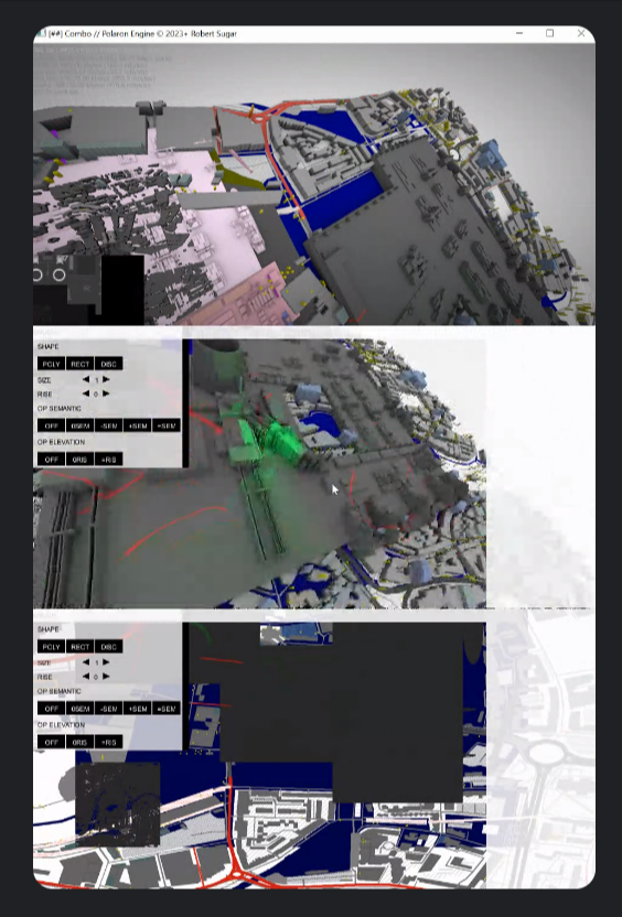
Push and Pull
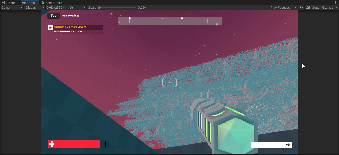
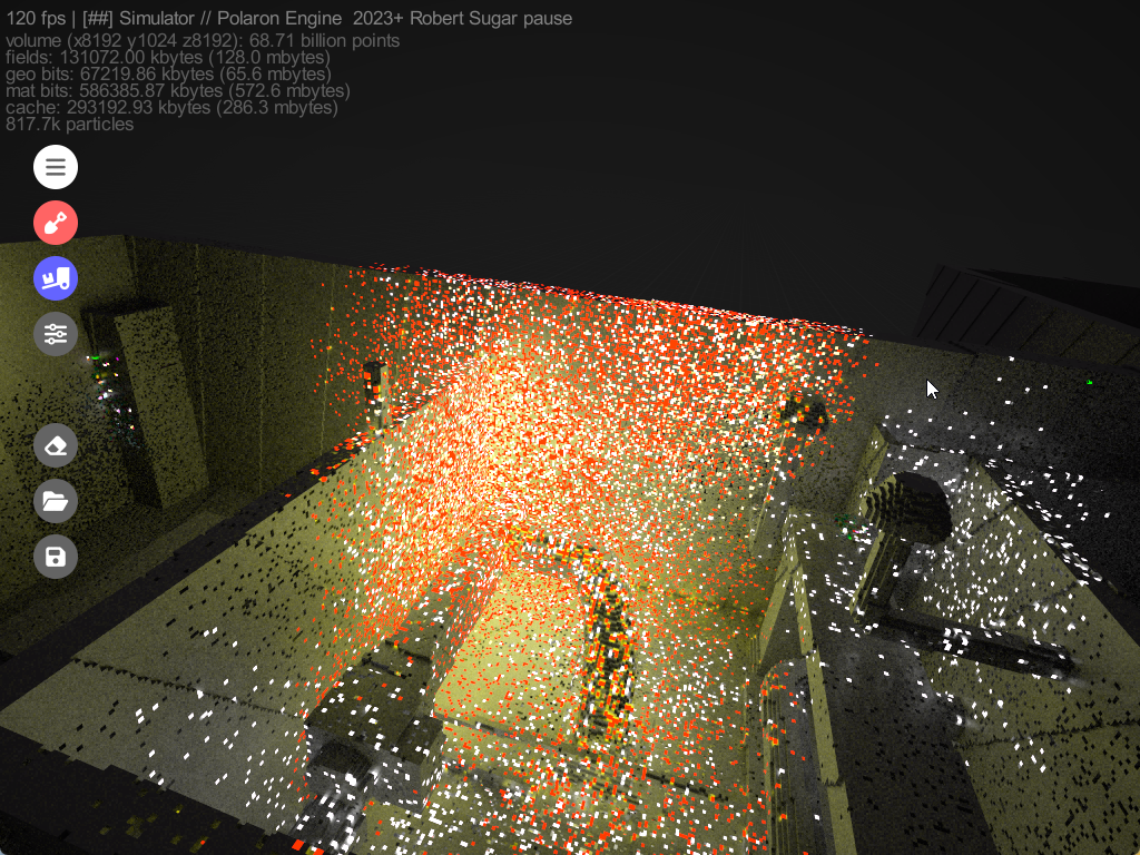
Above is a screenshot from a Basic Export of a Mesh from Polaron > Unity into their Demo Shooter Model. We can send geometry, data, or other complexity (e.g. beyond the players tile / Aoi) to allow full 3D experiences to be driven by simulated events beyond. This allows for synchronisation of effects and changes in both 3D, AR / VR and large scale terrain environments.
We encourage interaction and integration into these tools and systems. Since the overall experience is often the sum of it’s parts – just as there are many steps involved in processing satellite data or running complex interactions on Spatial data or even Game Mechanics – Polaron was architected and designed from the ground up with spatial data processing and performance in mind.
Scale, Fidelity & Interoperability
We can’t do all things or be all things to all people. Therefore we decided early on to allow a lot of interaction into existing services and systems; in order to augment and expand and allow far greater complexity and scope of application in Polaron.
We can use this versatility for a lot of different types of simulation, from representing damage in an environment to simulating a City and procedurally generating infrastructure and pathfinding through a dynamic environment (close roads, remove bridges or factor in heat and temperature into your planning).
OSM & large scale data
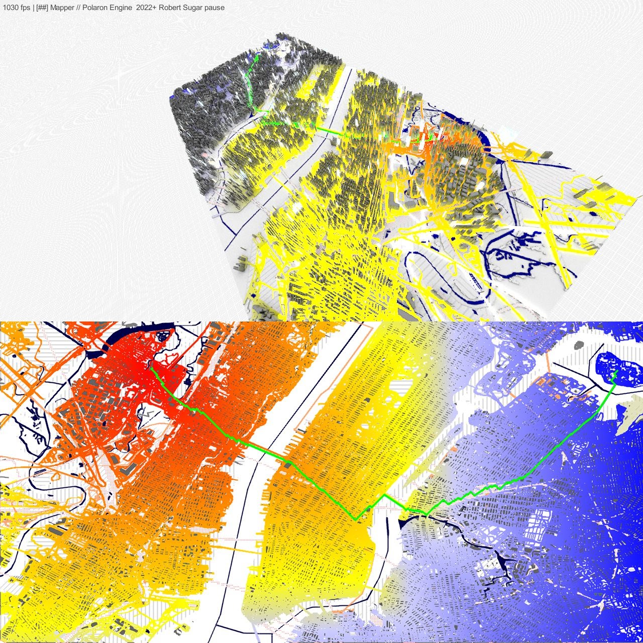
Polaron can expand the OSM database (a few billion nodes) into many trillions of points. Each of which can then be packed with data that can change and update.
- E.g. What buildings are powered by what supply – whether this is water, power or sewage and to then use inference and correlation to see how changes might affect different systems.
- This allows for partial data to be extrapolated into likely patterns – and also to estimate the impact of change.
- Cost can also be considered – whether financial cost of digging up or modifying a given location or the cost and impact of changes.
- Risk & Cost are closely related – and often the product of multiple variables – which again permits complex granular interactions interpolated or directly simulated from imperfect data.
- Since real-world data can also be used as a baseline or control – this permits a hugely powerful mechanism to simulate and assess change.
So what are you doing with this?
We’re developing the tech stack to enable us to engage with lots of different markets and verticals from the deep tech perspective whilst focussing on delivering our own products.
Gaming & Entertainment
Our CEO created and sold two game development companies in his twenties before returning to look at simpler things such as galaxy formation simulation on super compute clusters.
We think that a voxelised environment where the world is interactive and consequential presents an amazing experience and will allow us to gamify the complexity behind the scenes to make something really special.
Simulating history
We are looking to take real-world data, and produce simulations of different scenarios based on historical events – in order to drive interesting experiences based on real events, augmented, analysed and tied together by simulation.
We believe this might be the next iteration from Story based mapping and historical modelling.
Serious Simulation

Polaron is rooted in computer science and we want to continue to refine our models, whether that’s the physics of how damage to a structure occurs, or how terrain change, and interactions can produce different results.
Famously; “all models are wrong, but some are useful” is driving the development of the more serious sandbox allowing complex, interoperable & qualifiable simulations.
Want to find out more? Or want to work with us?
We’re always looking out for interesting projects, be they commercial, GIS, R&D or gaming applications and we’re looking to grow out team. If you like what you’ve read do please get in touch – and we can have a conversation. We will endeavour to get back to you ASAP!