Polaron wins best-in-class technology:
“Best adaptation of existing technology for public safety use in the NIST 2022 – Commanding Tech Challenge.”
NIST Link: NIST – Commanding Tech Challenge
Challenge Link: Challenge.gov
About the Command Dashboard Integrating Next-Gen Technology Challenge (CommanDING Tech)
Compete for $1M in total prizes, innovate with public safety plus a chance to demo your dashboard at a live event. The National Institute of Standards and Technology’s Public Safety Communications Research (PSCR) Division is hosting the Command Dashboard Integrating Next-Gen Technology (CommanDING Tech) Challenge. This is a four-phase competition looking for the best next-generation incident command dashboards.
Through improved user interfaces and user experience (UI/UX), and the ability to work with video, sensor, and map data in multi-story buildings, PSCR aims to enhance the quality of incident command dashboards. This, in turn, bolsters the effectiveness of emergency response. Contestants will introduce new technology to the arena or enhance their existing technology throughout the Challenge. The finalists will display their dashboards by executing a public safety emergency scenario in real time. Dashboards can incorporate a range of technologies, including virtual reality (VR), augmented reality (AR), web-based, and hand-held devices (phone or tablet).
All entries must integrate and respond to multiple data feeds. They must also offer a mobile, intuitive user interface, making it more efficient for public safety officers to react to emergency scenarios. PSCR and its Challenge partners will distribute prizes worth up to $1,000,000 to eligible Contestants.
A special thank you to our collaborator Fabio da Silva – CEO of Wavesens Ltd – our ally in this application and the leader of Team Thrusight. This team was a 2nd round victor of the PSCR – FRST Challenge, focusing on the remote tracking of firefighters using UWB Radar.
Background Information
The aim of this Challenge is to utilize current technology both within and outside the incident command sphere and motivate enhancements in the quality, usability, and functionality of incident command dashboards for first responders. Present dashboards often fall short due to their user interface quality, data access capability, or cost to the public safety institution. Consequently, public safety responders still depend on manual strategies for staging and addressing emergencies. This Challenge aspires to introduce dashboards employing multiple tech solutions, including VR, AR, mobile, and web-based. All Challenge submissions must show an upgrade to their enhanced dashboard during the competition. Public safety specialists and video and data analytics experts will back the Challenge, aiding participants in progressing and refining the state of the art of incident command dashboards.
Command Dashboard Integrating Next-Gen Technology Challenge for Public Safety
The National Institute of Standards and Technology’s PSCR Division is orchestrating the CommanDING Tech Challenge. This four-phase contest seeks the premier next-gen incident command dashboards. With refined UI/UX and the capacity to manage video, sensor, and map data in multi-floor structures, PSCR intends to uplift the quality of command dashboards, subsequently enhancing emergency response effectiveness.
Contestants will introduce innovative tech or enhance their current solutions during the Challenge. Finalists will present their dashboards by undergoing a real-time public safety emergency scenario. Entries can employ various technologies like VR, AR, web-based, and handheld devices.
All submissions should integrate with and respond to numerous data feeds, ensuring a mobile, intuitive interface. This enables a more streamlined and effective response for public safety officials during emergencies. PSCR and its Challenge associates will offer prizes valued at up to $1,000,000 to contestants that fulfill eligibility criteria.
Demonstration
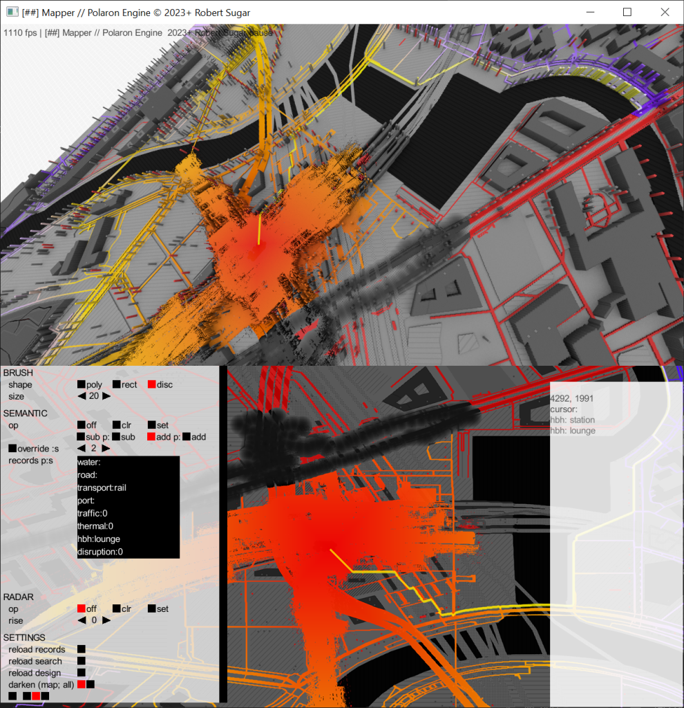
We have achieved the capability to “paint” areas within a scene. This allows multiple users to execute diverse tasks with robust object and pose tracking within the setting. It empowers a fire commander to construct a situational awareness representation from varied sources like radio reports, sensors, UAVs, and more.
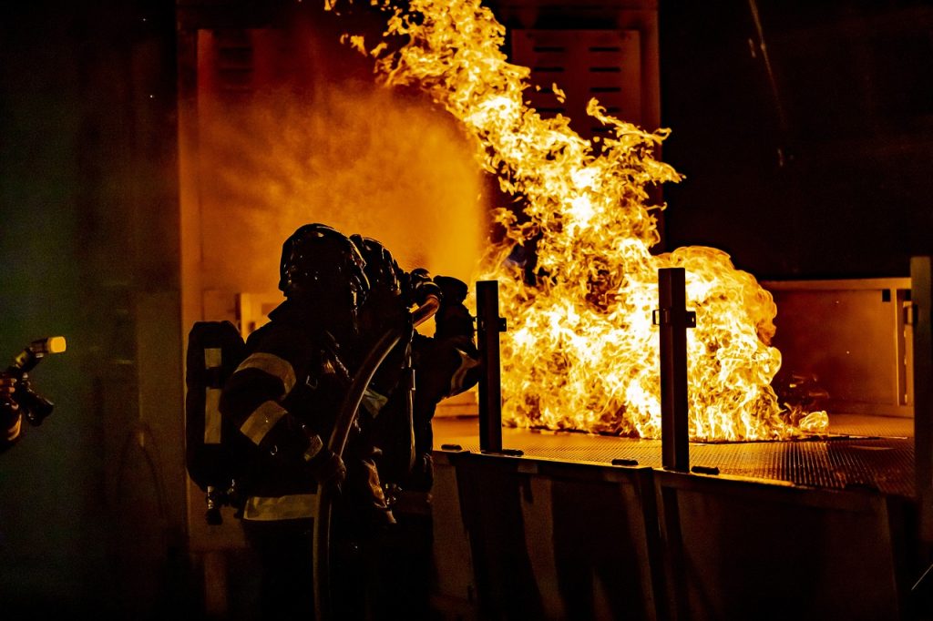
Emergency Situations & Their Complexity
Emergency scenarios are intricate, time-sensitive, and demanding events. An efficient public safety response necessitates appointing a commander, allocating resources, mapping the impact zone, tracking individuals and objects, pinpointing areas of concern, and more.
The CommanDING Tech Challenge by PSCR strives to augment the quality and usability of incident command dashboards. The challenge focuses on enhancing existing dashboards and also paves the way for new entries. PSCR seeks dashboards that boost public safety officials’ capability to handle emergencies, emphasizing effective UI/UX, data management from sensors and video feeds, and 3-D space positioning. This challenge will conglomerate first responders, video analytics experts, public safety professionals, and contestants to push forward the quality and availability of Incident Command Dashboards for public safety.
Capability & Automation
In the real world, especially on a fire ground, information can sometimes be ambiguous or uncertain. Polaron permits the consideration of uncertainty in the simulation, along with rapid mapping, even manually, of an evolving environment. This fusion of human and sensor-derived data constructs a maximum likelihood image. It also lets other supportive capacities, like other fireground commanders and command centers, alleviate the load on the primary fire commander. Polaron’s High-Level Architecture permits bidirectional integration. It allows various Command & Control functionalities to both extract and feed data to/from Polaron. This results in enhanced situational awareness and more informed decision-making within 2D & 3D displays. This information can also be relayed to phones, tablets, APIs, and reports.
- Paint the likely locations of civilians and casualties for resource vectoring, considering the associated risks.
- See through walls to gain insights on internal layouts and use tracks from body-worn systems to chart the internal spaces.
- Utilize propagation modeling to estimate the best positions for RF transceivers and relays.
- Evaluate the viability or benefit of a dynamic entry into a space or where over-pressurized ventilation can be most effective.
- Simulate resources and impact over a broader area in the same simulation as the 3D model, contextualizing the fire ground within a larger region.